
Round trip 16 days Baliem valley and Raja Ampat homestay
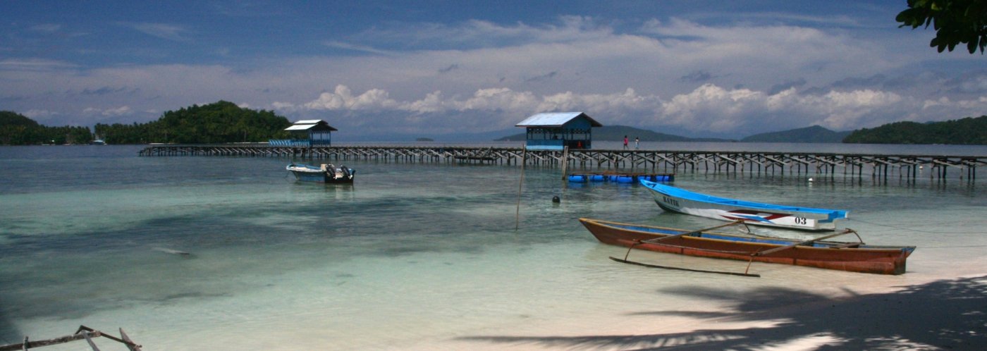
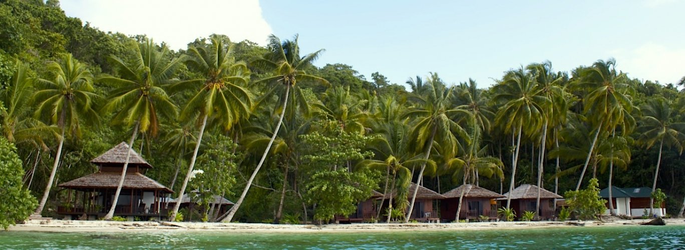
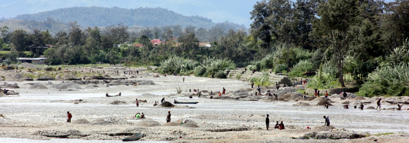
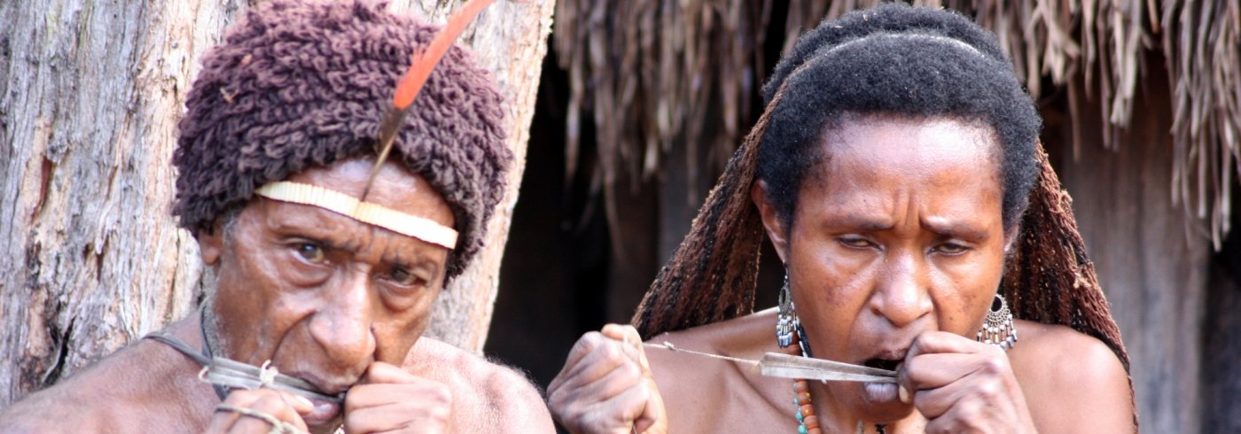
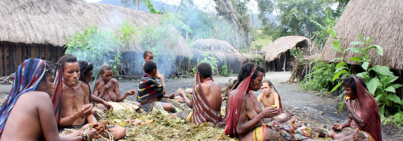
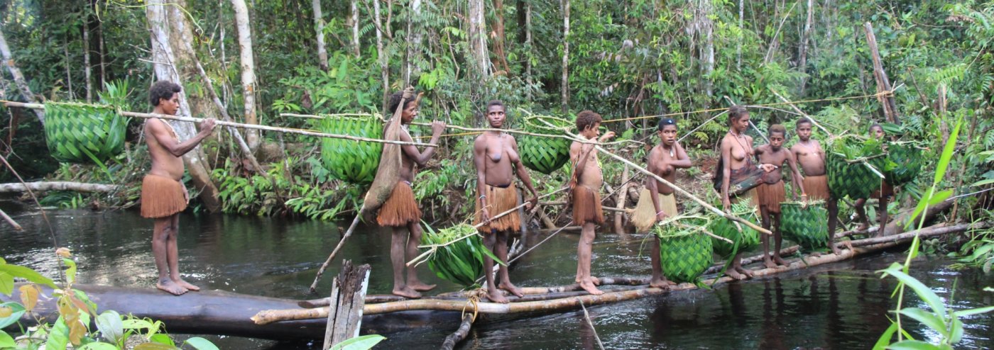
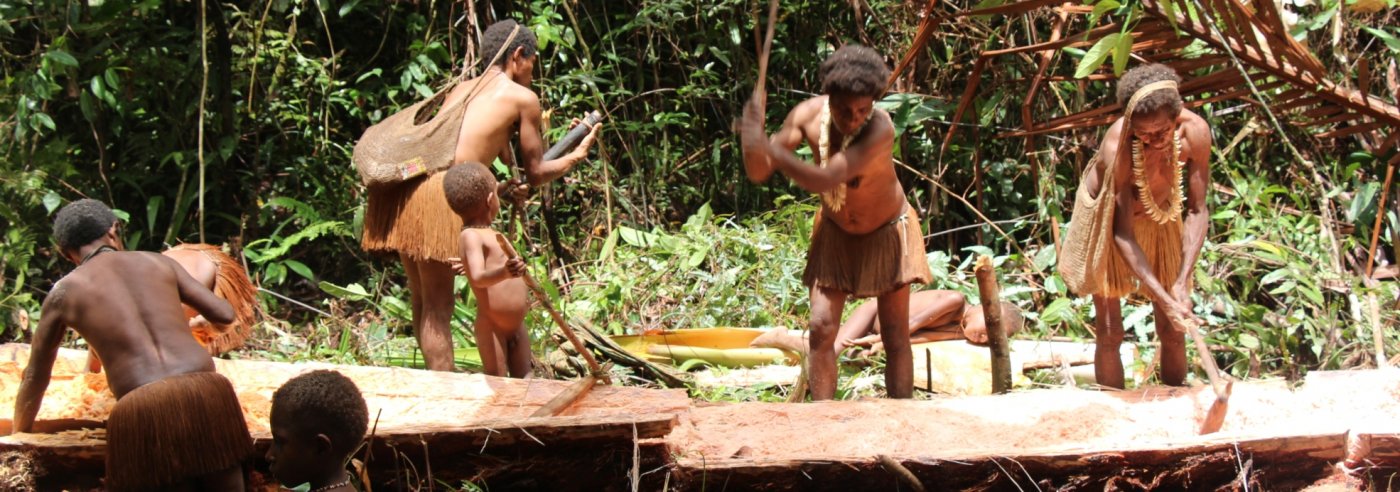
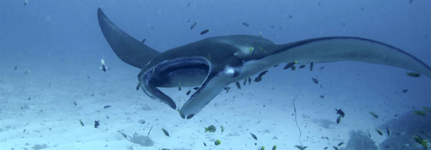
Jayapura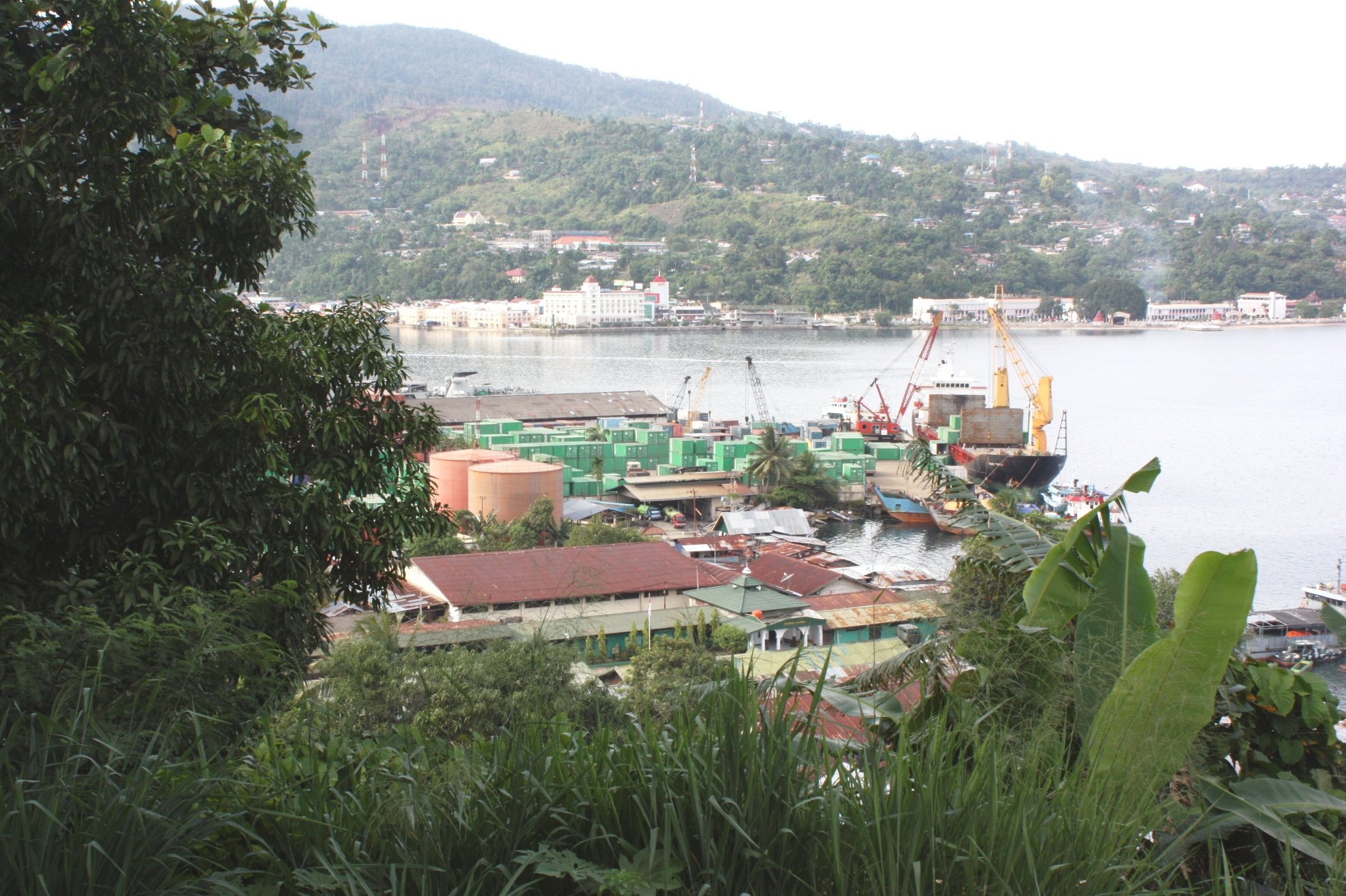 JayapuraJayapura is the capital of the Papua province. Because of its location between mountains, the city is divided into different "pieces". You have the city itself with the old Kloofkamp district, and further in the area the "districts" Hamadi, Enterop, Kota Raja, Abepura, Dok2 to Dok9, APO (American Post Office).Jayapura Airport is 25 kilometers away at Sentani Er. There are several flights a day, including to Jakarta, Makassar and Denpasar and to many small destinations in Papua, including the Baliem Valley. 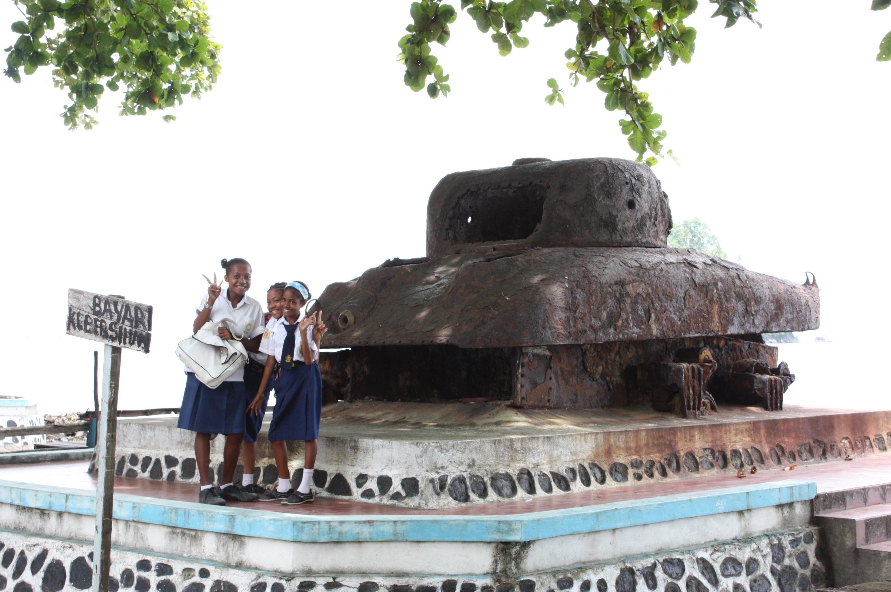 HistoryThe city was founded as Hollandia after having determined the border between England and the Netherlands,that runs midway across the island New Guinea. The Dutch founded Merauke close to the border in the south and, as said, Hollandia in the north.This to restrain possible expansionism of the English.Later, after that Dutch Nieuw Guinea was incorporated into Indonesia, the city was shortly named Soekarnopoera, and then renamed Jayapura. During the Second World War the city was the headquarter of The American Army and several things remind of this. The district APO for example, which stands for American Post Office. Here was once the post office of the American army. The beach north of the city is called Base G. And on the hills you can still find aircraft wrecks. (Source: Wikitravel) Things to seeOn the way to Jayapura airport is Museum Negeri. In the museum you can learn a lot about the different tribes in Papua. There are beautiful objects on display.Gedung Loka Budaya Museum is located on the grounds of Cendrawasih University in Abepura, a kind of suburb of Jayapura. The museum has a wonderful exhibition of objects from Irian Jaya. A large part comes from the Asmat area. There are a few beautiful beaches close to Jayapura. Hamadi Beach, where Allied forces landed in WWII, is about 15 minutes from Jayapura by bemo. The beach is located near a busy inhabited area and is very busy. The Base G beach, which owes its name to Mac Arthur who had his headquarters here, is a nicer beach. This beach is also not far from Jayapura and can also be reached by bemo. Lake Sentani is 40 kilometers from Jayapura, see Sentani. Wamena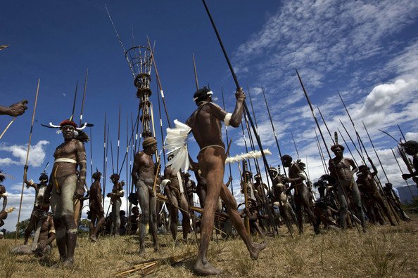 WamenaThe Baliem Valley is located on a plateau in the province of Papua. The valley is located at an altitude of about 1,600 meters, making it a lot cooler than at sea level. Wamena is the capital of the Baliem.The town has just under 15,000 inhabitants and is often the base for excursions and treks through the Baliem Valley. The airport has several daily flights to Jayapura and daily to Timika and Dekai (towards Korowai). Be sure to visit the Pasar Jibama market here. The valley itself measures approximately 20 x 80 kilometers and is the habitat of the Dani tribe. The Lani and Yali live at a somewhat greater distance from Wamena. The basic food in the valley is the sweet potato. Rice doesn't grow here. Furthermore, vegetables are grown and pigs are kept (and cherished!). A trip to the Baliem Valley is like a trip with the time machine. The population lives very primitively in small bead villages with at most ten mud huts with thatched roofs and a large communal kitchen. The pigs also often have one of the huts. The men usually only walk with a koteka (penis sheath) and the women only wear grass skirts. It is wonderful to walk in the Baliem Valley. Enthusiasts can take a multi-day trekking, but the day trips from Wamena also invite you to explore the valley. At the village of Sogokmo you cross the river via a suspension bridge and walk through the sweet potato fields past several traditional villages. At the village of Jiwika you can climb to a traditional salt mine and at Kurulu you come face to face with the famous ancient mummy of the Dugum clan. You can also view such a mummy at Alkima, but it has now become a touristic event. It is also special to spend part of the day at the Pig Festival. Normally the party is held during a wedding, but the residents are proud of their traditions and are happy to show it to tourists. A pig is slaughtered with a bow and arrow and stewed on hot stones. As a guest you will be offered a piece of meat with vegetables. Tasty is different, but just to be polite you grab a bite and then enjoy the lunch that your guide has brought. The Baliem Festival takes place annually in the month of August. The three Dani, Lani and Yali tribes wage war for three days, but now with different rules of the game than before. Baliem valley - TribesThe original population are the Dani people, a well-known tribe in Papua. The Dani are known for their war-minded attitude. When the valley was discovered, people noticed that everywhere high, slim towers had been built. These were lookouts to warn the villagers that hostile clans were approaching. These lookouts were little by little put down when the area got under Dutch administration and war-making was forbidden. The Dani of the Baliem valley are related to the tribes from the mountains west of the valley, that are called western Dani or Lani. Their area is more densely populated than the area of the Dani. A third tribe are the Yali, who live in sparsely populated areas high on the mountain flanks of the Jayawijayain mountain chain.Under Indonesian administration in the 70’s the situation became tense with the Dani, who were considered as underdeveloped people. In the early seventies the Indonesian government tried with 'Operation Koteka' to motivate the Dani to change their Koteka for clothes and to house them in modern square houses. Many Indonesian soldiers, who had to carry out the policy, regarded the Dani as 'savages' (little more than animals, an attitude that’s still alive among many Indonesians) and treated them very badly. Opposing Dani were sometimes even killed. In 1977 the Dani rebelled led by the Organisasi Papua Merdeka, the Dani fought with bow and arrow against Indonesian soldiers with rockets, attack planes and helicopters with which they bombed the Dani villages. It is estimated that 500 Dani died during the fighting, that was concentrated around the villages Pyramid and Bokondini in the north of the valley. 'Operation Koteka' was a complete failure. In the nineties a new fight broke out for independence, which also was put down violently by the Indonesian government, that in 1997 even tried to put up the tribes against each other and thus stay out of range itself. Until the middle of the 20th century the valley was closed territory. A lot of Indonesian government officials still consider the valley as ‘the end of the world’. (Source: Wikipedia) Raja Ampat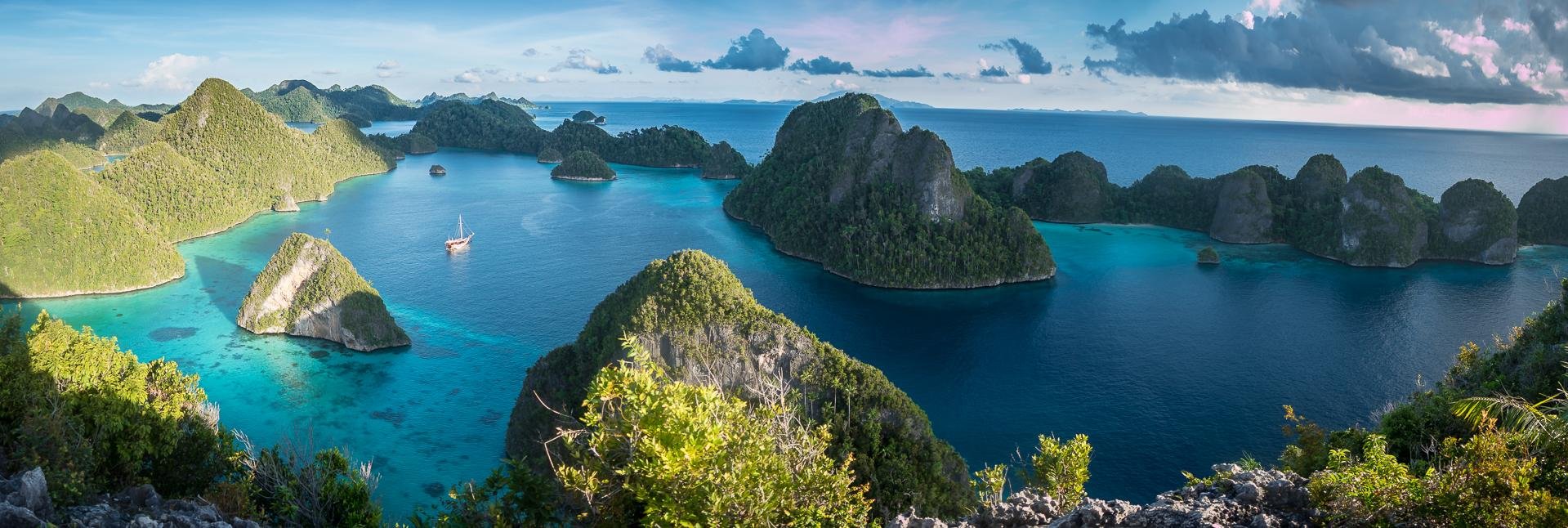 Raja AmpatRaja Ampat is an archipelago in West Papua (former Irian Jaya) and consists of 610, mostly uninhabited islands. The four largest islands are Waigeo in the north, Salawati (southwest of Sorong), Batanta (north of Salawati) and Misool in the southwest. The name Raja Ampat is also based on these four islands and literally translated means "the four kings".Raja Ampat is a relatively unknown area in Indonesia, but this destination is well known among divers. This is due to the wide range of various fish species and fantastic coral reefs, varying from hard to soft coral. But the islands themselves are also impressive. The Raja Ampat Islands have quiet lagoons with crystal white sand and water that varies from bright green to bright blue. Diving is especially popular in the Dampier Strait. Here you will find numerous dive spots with an incredible amount of coral and fish. Cape Kri, Blue Magic and Manta Point are real eye-catchers. Misool is also loved for its wide variety of fish and coral. Raja Ampat is open all year round, but from mid-July to mid-September you are more likely to experience rain and high waves. Misool is closed between mid-June and mid-September. Raja Ampat has dozens of dive resorts and homestays. The homestays often use local diving schools, such as the Arborek dive shop. The more luxurious diving resorts offer not only more comfort, but also more safety. Sorido Bay resort, Raja Ampat Biodiversity and Papua Explorers are our favorites in the Dampier Strait, Papua Paradise Eco resort off Batanta Island. The Scuba Republic is an excellent middle class resort. A fast public ferry runs twice a day between Sorong and Waisai on Waigeo Island. Waigeo also has an airport with a daily flight to Sorong. 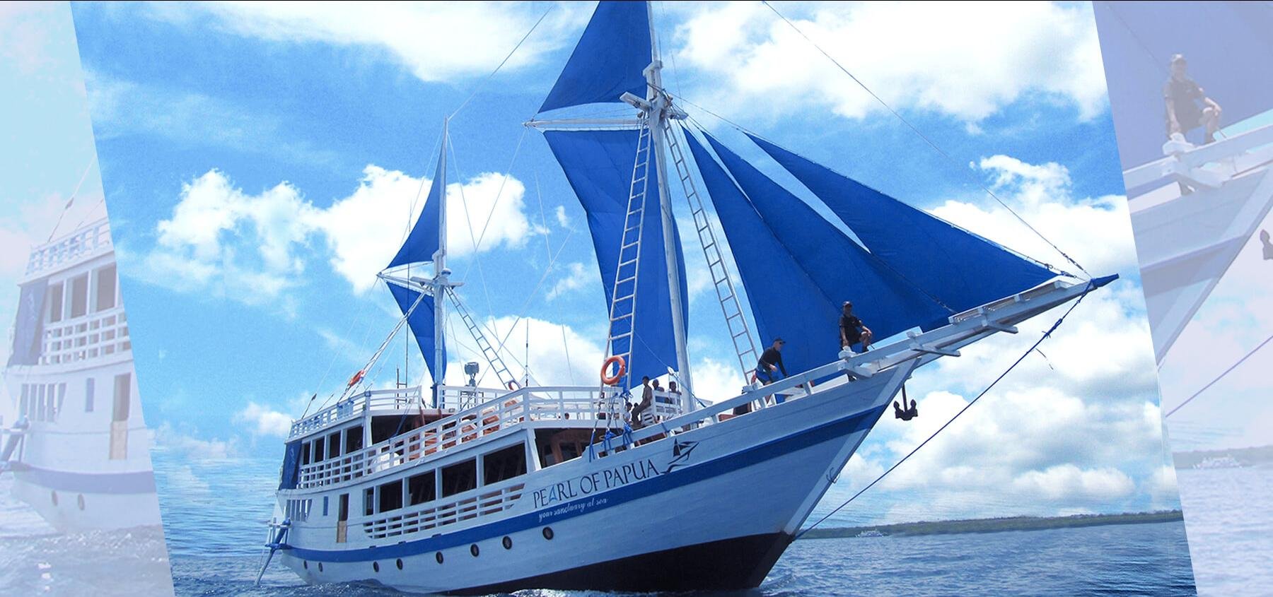 LiveaboardsLiveaboards usually offer weeklong dive cruises in northern Raja Ampat (Dampier Strait and the northern Wajag karst islands. Longer, often 10-day trips also cover the southern part around Misool. Most liveaboards operate Raja Ampat cruises between September and March April, then dock and sail in the waters around Komodo for the summer season.Video Raja Ampat snorkel cruiseSorong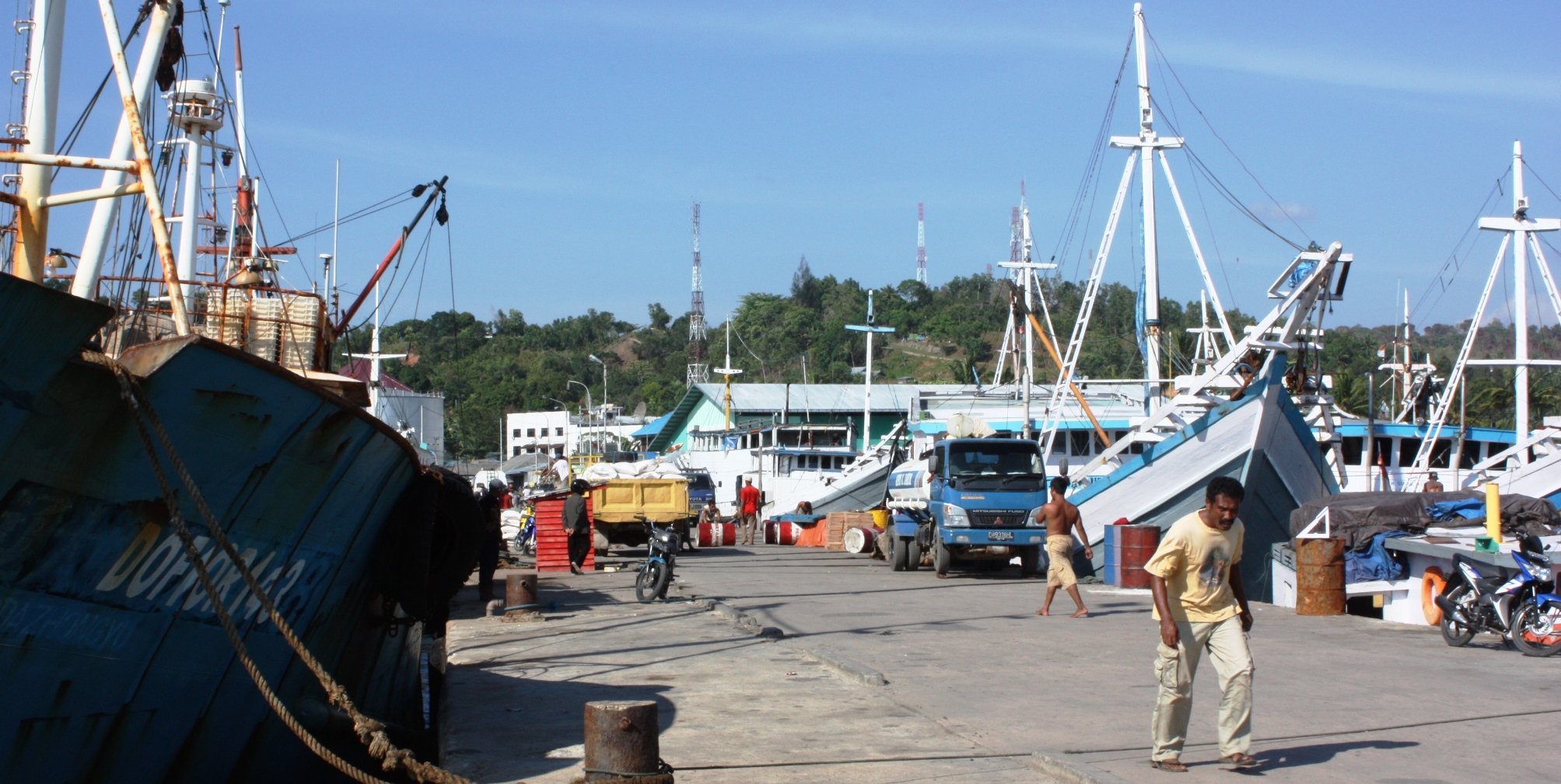 SorongSorong is the westernmost city on the island of New Guinea. The city is located on the Sele Strait of the Pacific Ocean on the Vogelkop Peninsula. It is the base for trips to the Raja Ampat Islands.Two hours' drive south of Sorong is the rainforest in the Klasow valley with all kinds of strange birds. You will find different types of Paradise birds and the endemic Cassoway, a peacock or smaller ostrich species. Sorong is the logistical center of the oil and gas industry around West Papua, which manifests itself in growing wealth and economic prosperity. The city has over 50,000 inhabitants, making it one of the larger cities of Papua. Most of the inhabitants are transmigrants from Sulawesi, Java and other islands. Directly off the coast is the island of Jefman, which until 2012 had the airport of Sorong. The new airport has daily connections with Jakarta, Makassar, Manado, Ambon and several cities in Papua, among others. Sites to seeThe city has a nice beach promenade and some historical buildings dating from the Dutch oil period. It’s a city full of contrasts. The following sights are close to the city:Cape Cassuwary: 3 km from Sorong, beach with coralreefs; Crocodile island, 500 metre out of the beach; The island Kafiau; The island Matan; The hot springs of Klaijili, 60 km from Sorong; A protected forest area, 15 km from Sorong; Sorong is the most important gateway for trips to the nearby Raja Ampat-islands and the coralreefs of the Coral Triangle. (source: Wikipedia) |


